Geoscience
AREAS
The Eddy Covariance & Net Radiation Infrastructure
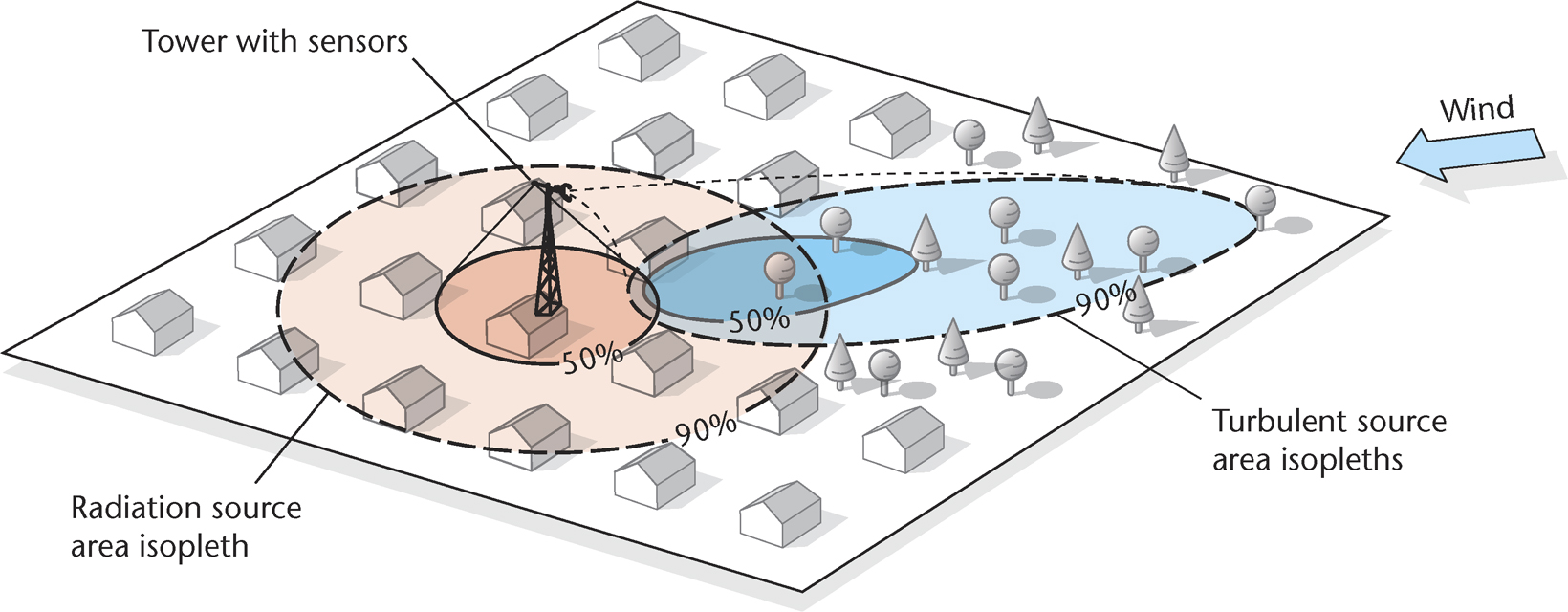
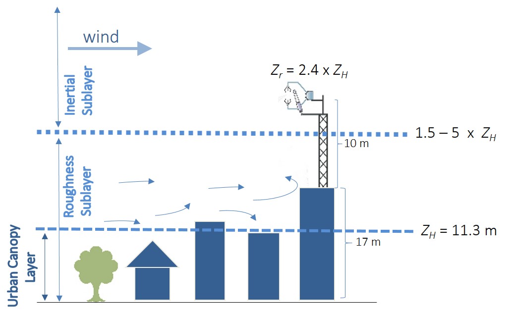
IACM operates a micrometeorological
tower carrying Eddy Covariance and Net Radiation systems in the city of
Heraklion, since 2016, to support urban climate and air pollution
research. The Eddy Covariance method uses the turbulent transport theory
in the surface layer of the atmospheric boundary layer to estimate gas
and energy fluxes at local scale, by exploiting the covariance between
vertical wind speed and the gas concentration and temperature, at a
specific observations height. In urban applications, the instruments are
placed high above the building canopy layer to measure an undisrupted
wind flow. The measurements are thus representative of an extended area
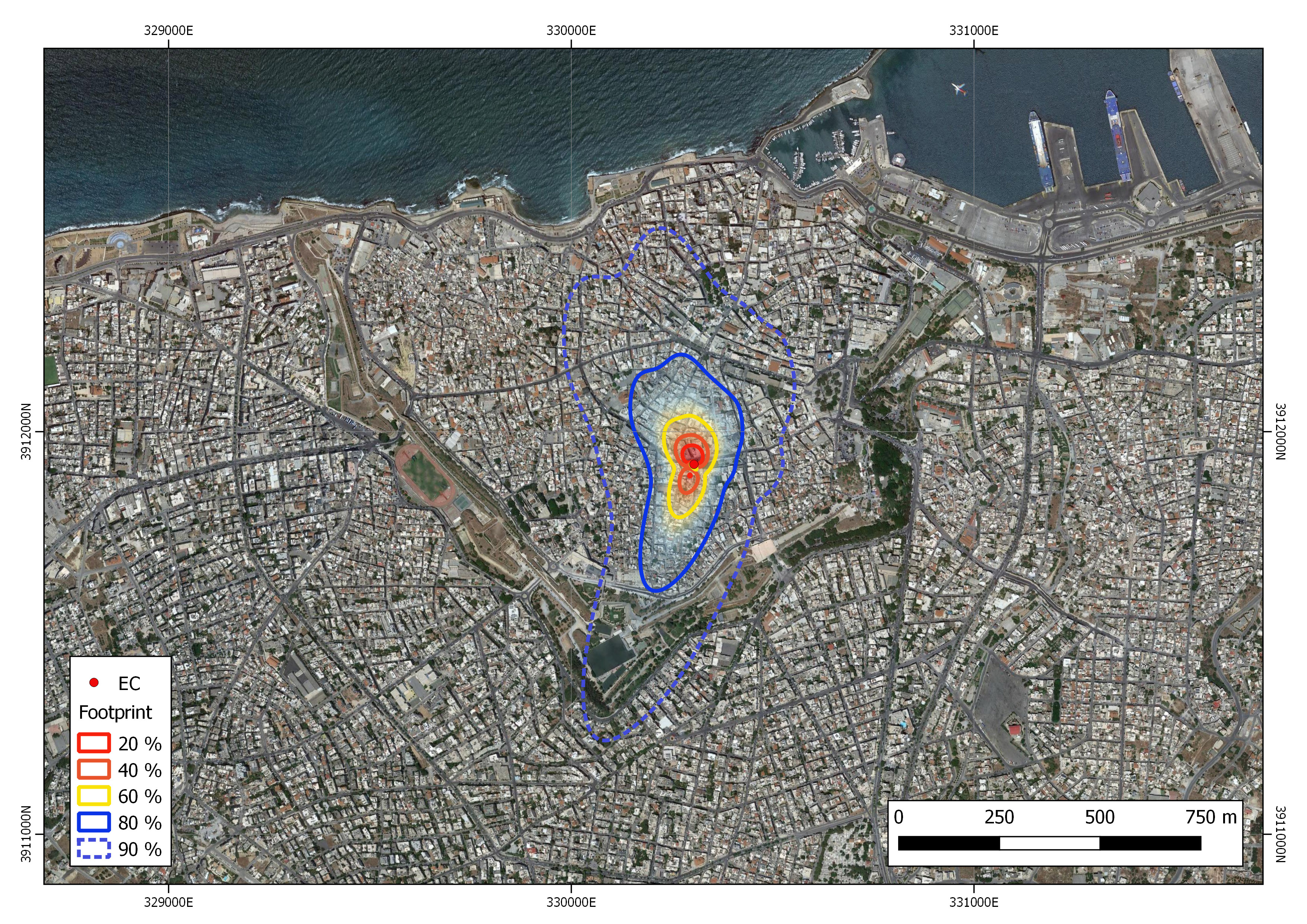
upwind (source area). The IACM Eddy Covariance infrastructure (IRGASON,
Campbell Scientific, Inc.) is able to measure turbulent sensible and
latent heat fluxes, as well as CO2 flux, whereas the Net Radiation
infrastructure (CNR1, Kipp & Zonen B.V.) is able to measure both
shortwave and longwave incoming, as well as outgoing radiation. All
observations available for spatio-temporal analyses in a central
database.
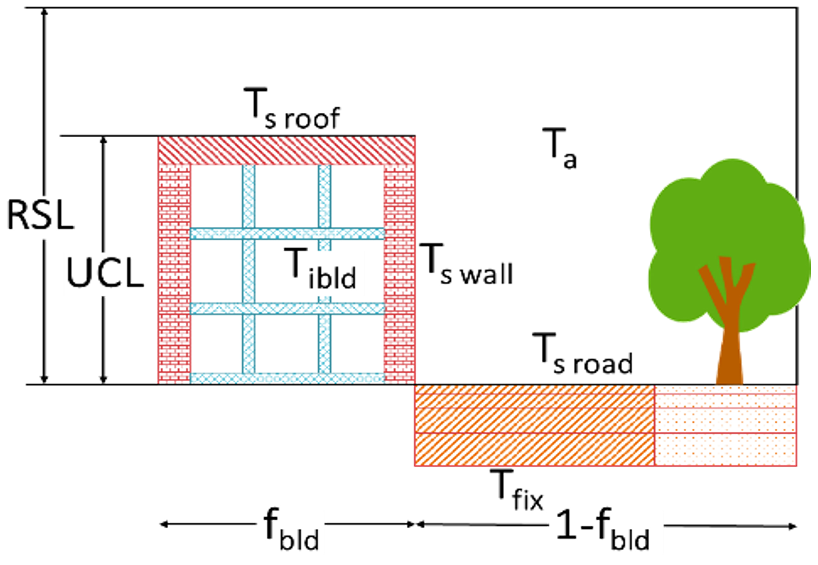
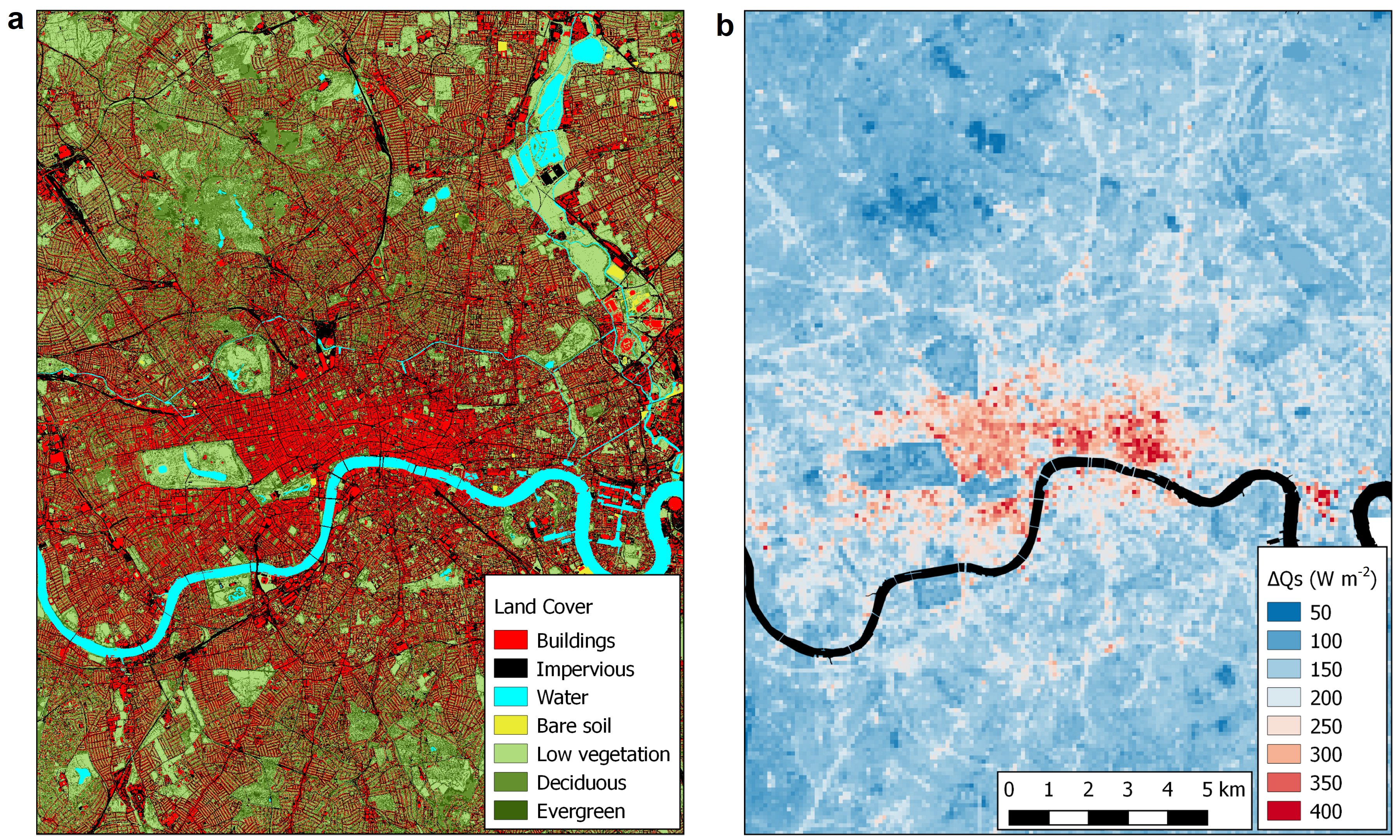
Estimation of Heat Storage in Building
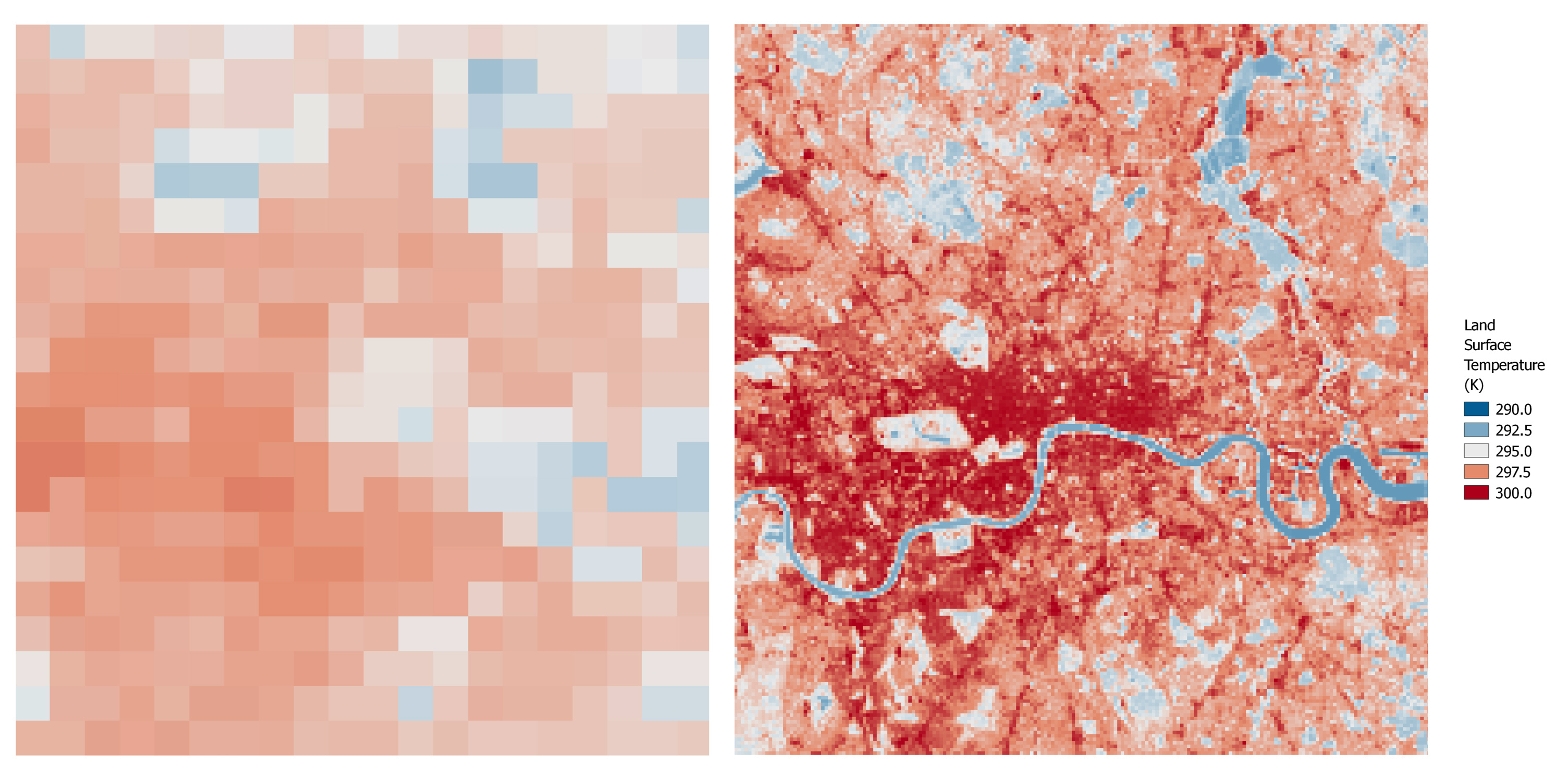
The net flow of heat storage (ΔQS) in an urban volume (i.e., air, trees, buildings, ground, etc.) is a main component of the urban energy balance. It is estimated by the Element Surface Temperature Method (ESTM), which reduces the 3D urban volume to four elements, i.e., building roofs, walls, and internal mass and ground (road, vegetation, etc.). Earth Observation is used to provide the fraction (fi) of each element within a specific grid cell, as well as the respective temperature (Ti), for urban areas, even for extended ones, such as London.
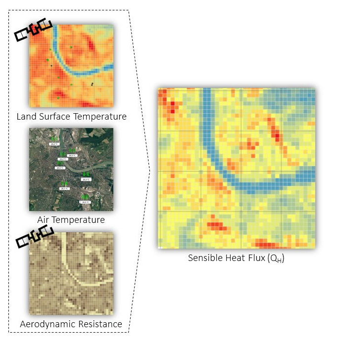
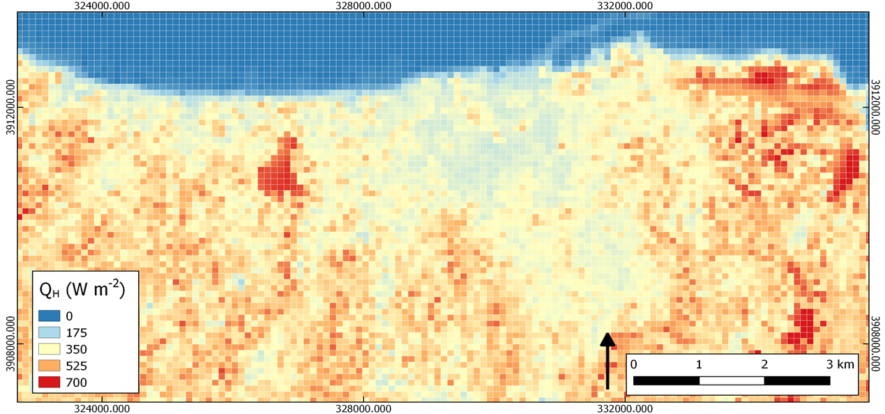
Estimation of the Turbulent Sensible Heat Flux
The turbulent sensible heat flux (QH) from the urban surface plays a key role in air temperature evolution and affects thermal comfort in cities. It is estimated by the Aerodynamic Resistant Method (ARM), which combines satellite derived surface temperature with in-situ derived air temperature patterns (measured by a dense network of stations) to estimate the temperature gradient at local scale. This temperature gradient is further combined with satellite derived aerodynamic parameters of the urban surface to estimate the heat that is transported by turbulence from the urban surface to the atmosphere.
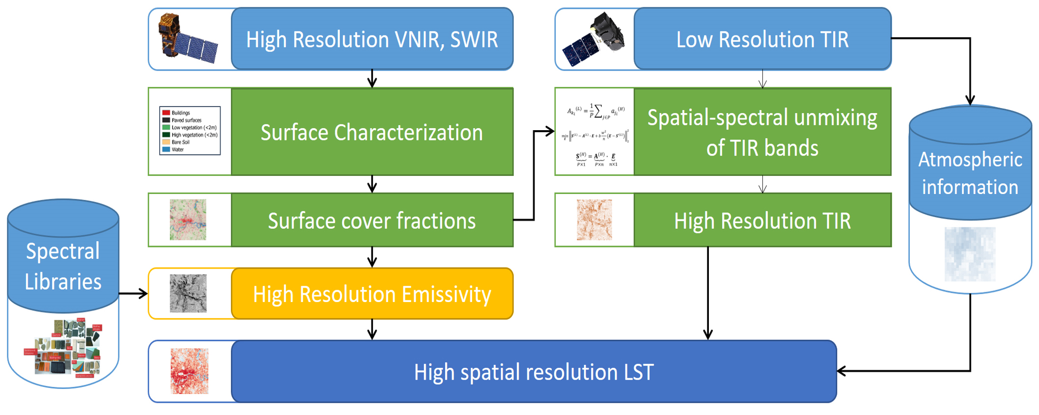
Land Surface Temperature downscaling
Currently, no space-borne sensor provides frequent thermal infrared imagery at high spatial resolution, therefore downscaling methods for retrieving land surface temperature (LST) at local scale is the only alternative. Synergistic approaches that combine the spatial structure of visible and near-infrared observations with the more frequent, but low-resolution surface temperature patterns derived by thermal infrared observations, provide excellent means for obtaining frequent LST estimates at neighbourhood scale in cities. Spatial-spectral un-mixing approaches allow high spatiotemporal resolution LST estimates, necessary in studies of urban climate and public health.
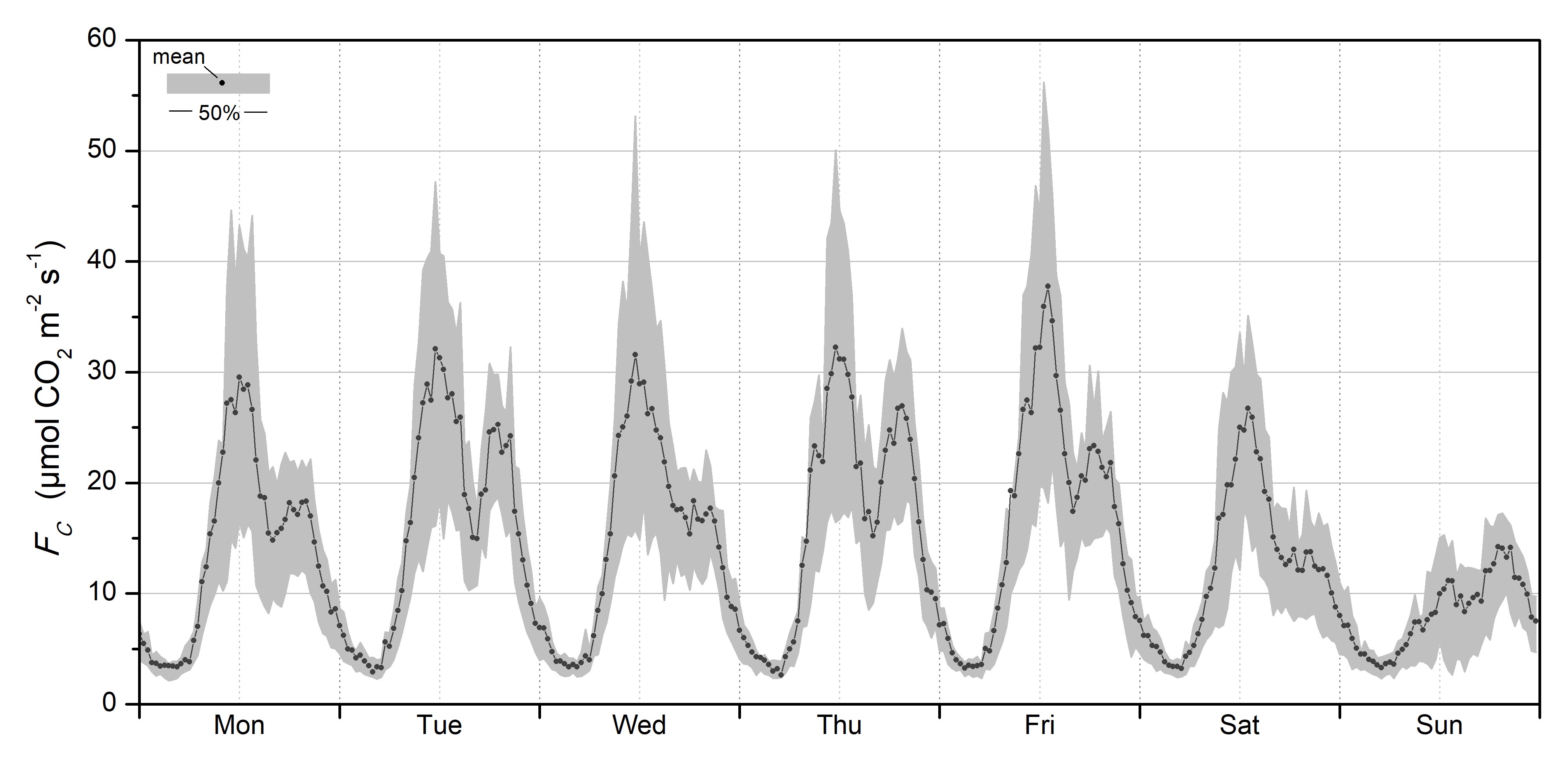
Mapping and monitoring the urban CO2 emissions
The spatial and temporal distribution of CO2 sources and sinks is extremely heterogeneous across the urban landscape. Monitoring urban CO2 flux is achieved in multiple scales by combining in-situ local scale Eddy Covariance (EC) measurements with Earth Observation (EO) datasets using advanced methodologies. Detailed urban land cover and morphology derived by EO are fundamental for the spatiotemporal interpretation of EC measurements and for the accurate parameterization of source area models. The methodology has been, among others, applied for Heraklion city centre to estimate the net annual CO2 emissions and the contribution of the different sources (i.e. traffic, buildings, human metabolism) to the total CO2 flux.
Earth Observation for Natural Hazards
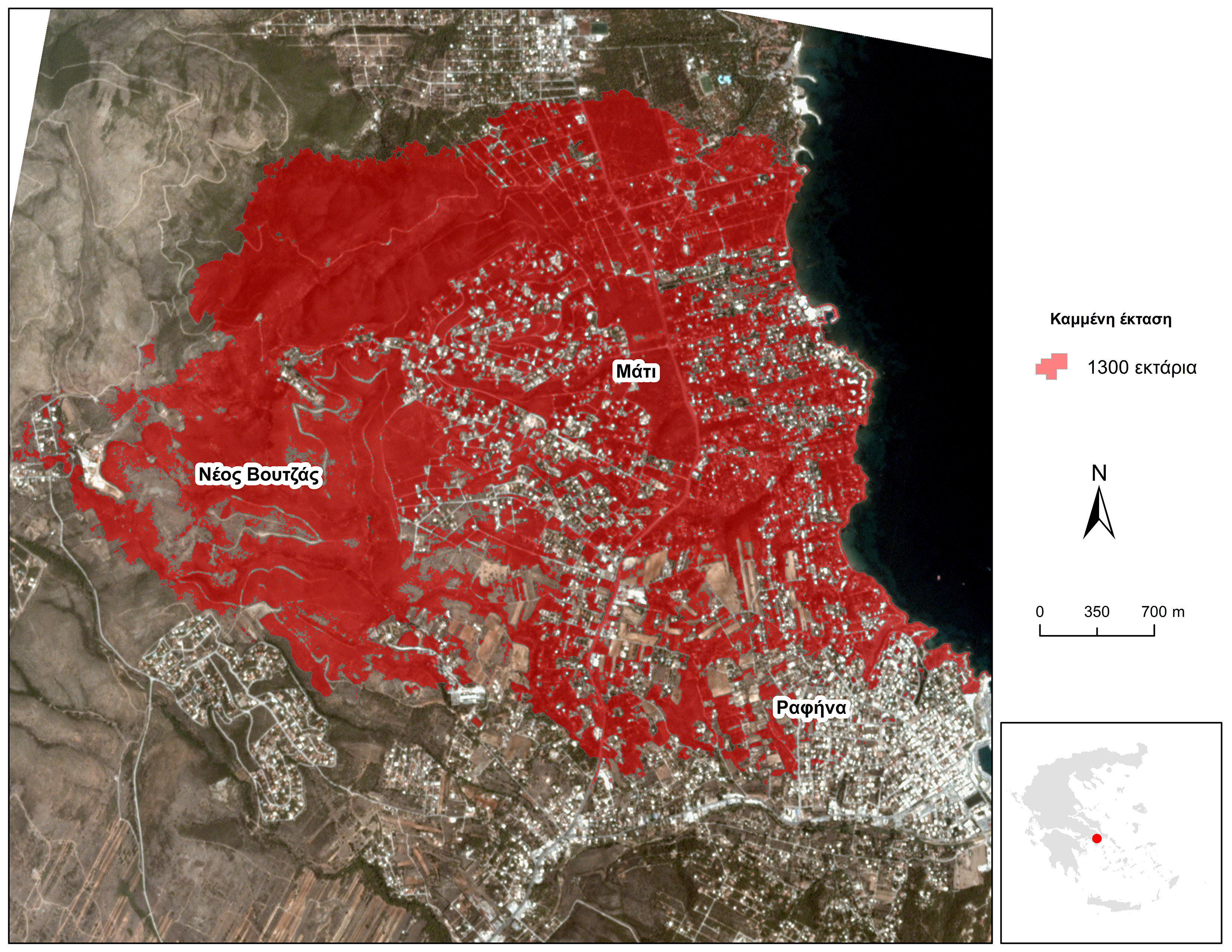
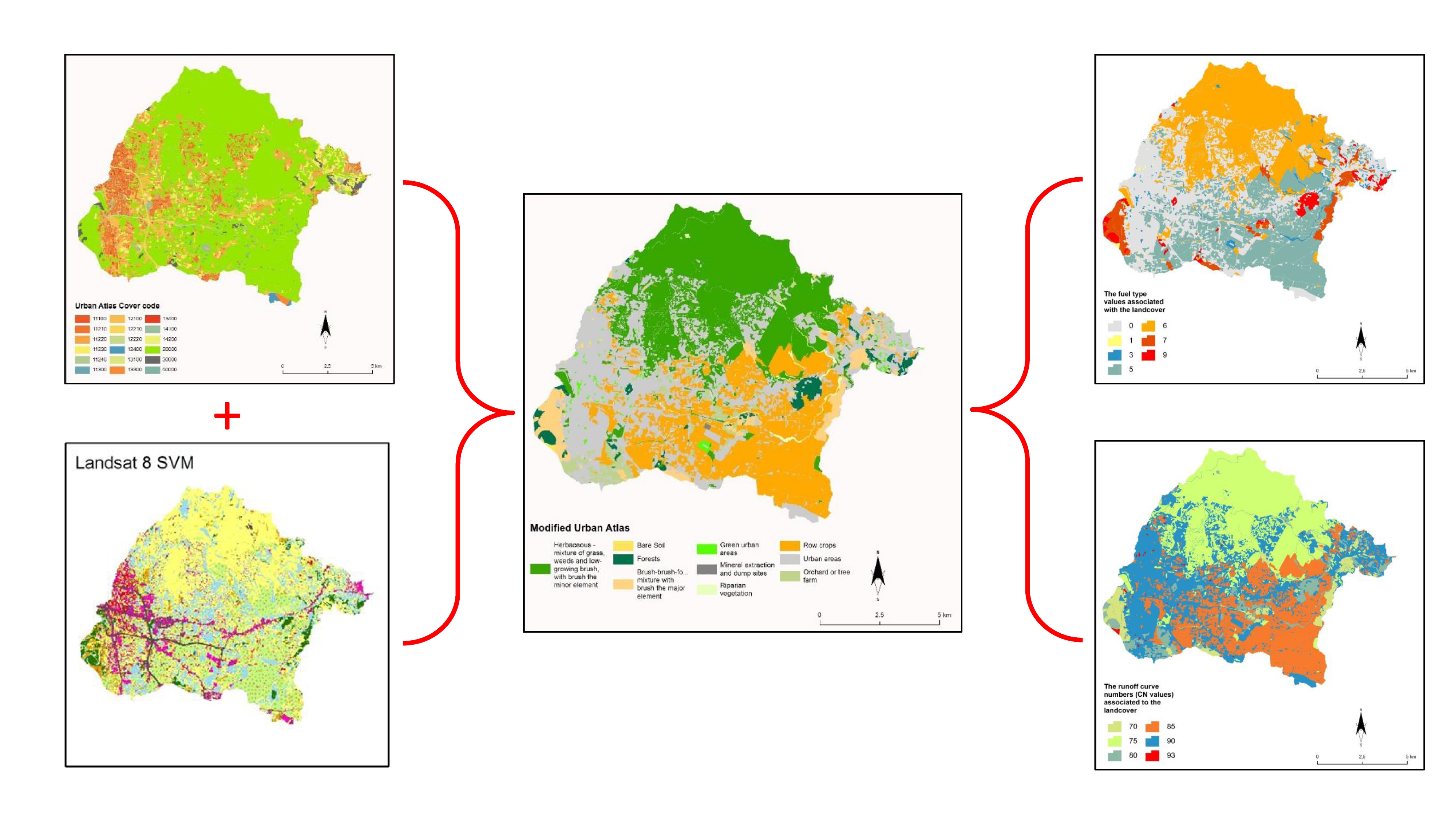
Natural hazards are phenomena with a large spatial dimension and impact. Their robust mapping and monitoring can be achieved by using Earth Observation technology. Fires are among the most frequent and severe types of natural hazards that affect Mediterranean areas during summer period. Satellite observations at various scales and frequency of acquisition are used in modelling simulations to support of pre-hazard mitigation planning, as well as in mapping activities to support post-hazard damage assessment in the affected areas. Advanced machine learning algorithms are used in both cases for extraction useful geo-information from the raw satellite observations in peri-urban areas.
Earth Observation for Ecosystems
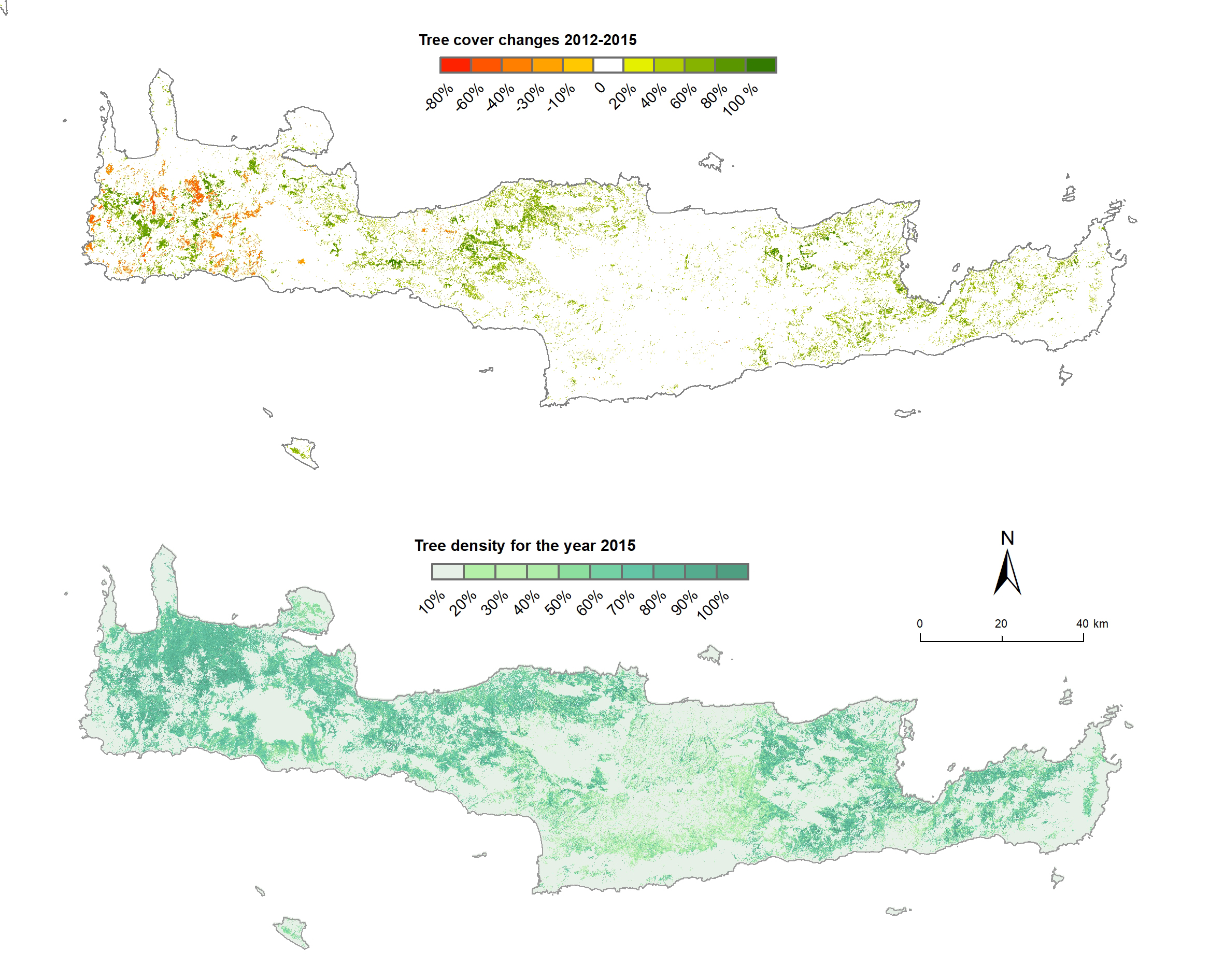
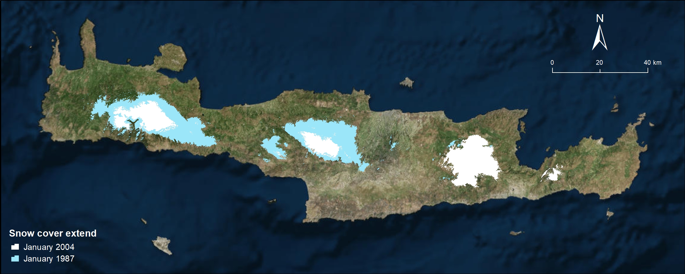
Anthropogenic and climate change pressures constitute serious threats to the integrity of the delicate ecosystems of protected areas, such as National Parks and Natura 2000 sites. Earth Observation data and tools are unique in the observation of changes and the tracking of variables related to degradation of ecosystems. Satellite observations at multiple scales in space and time are used in analysis of vegetation dynamics to monitor changes in land cover/use, snow dynamics as significant contributors to the water reservoirs as well as in ecological modelling to support planning of ecosystems conservation activities. This type of analyses usually involved long time series of satellite imagery at high spatial resolution (Big Data), therefore need specific analysis tool, often based on cloud computing.
Earth Temperature Observation in Coastal Areas Research
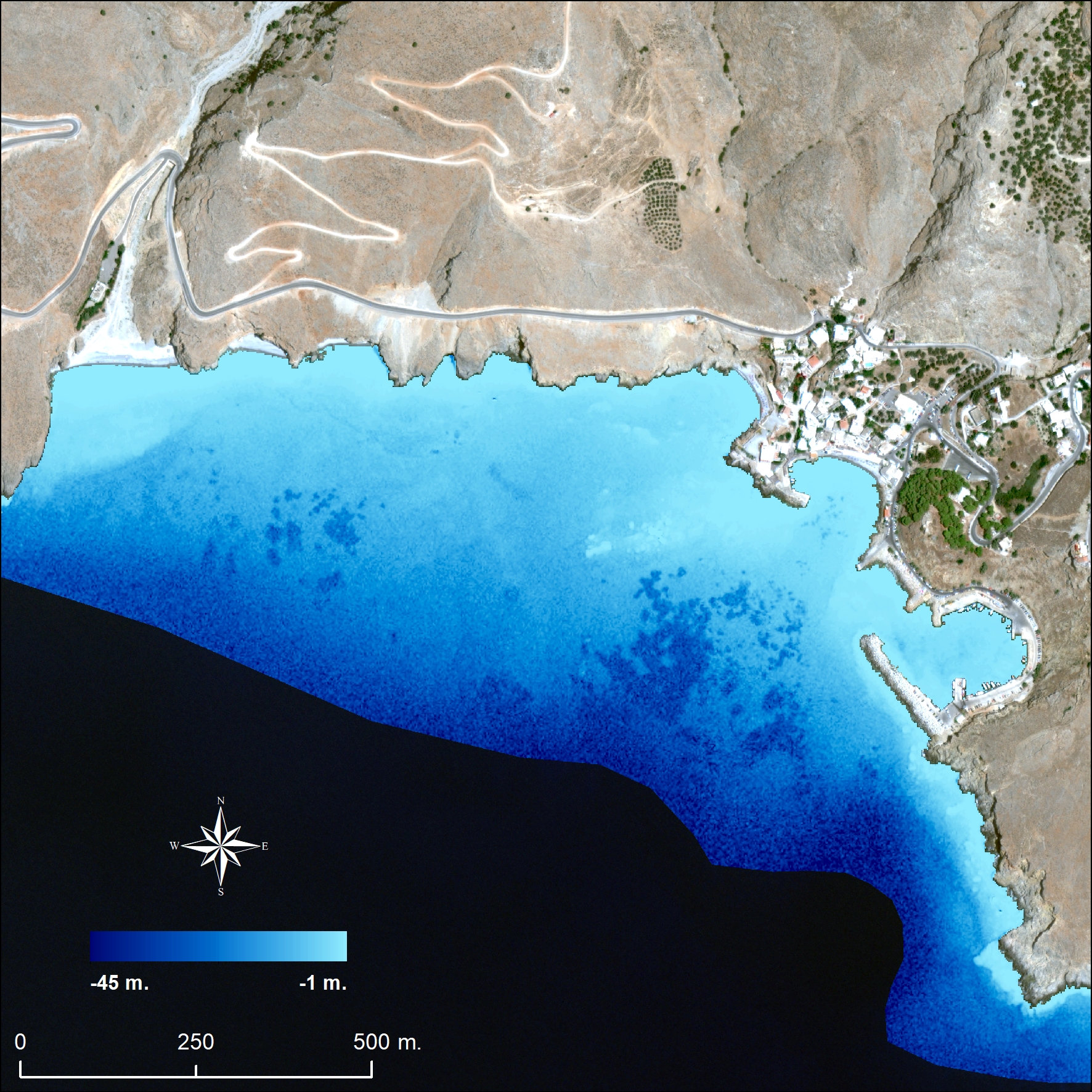
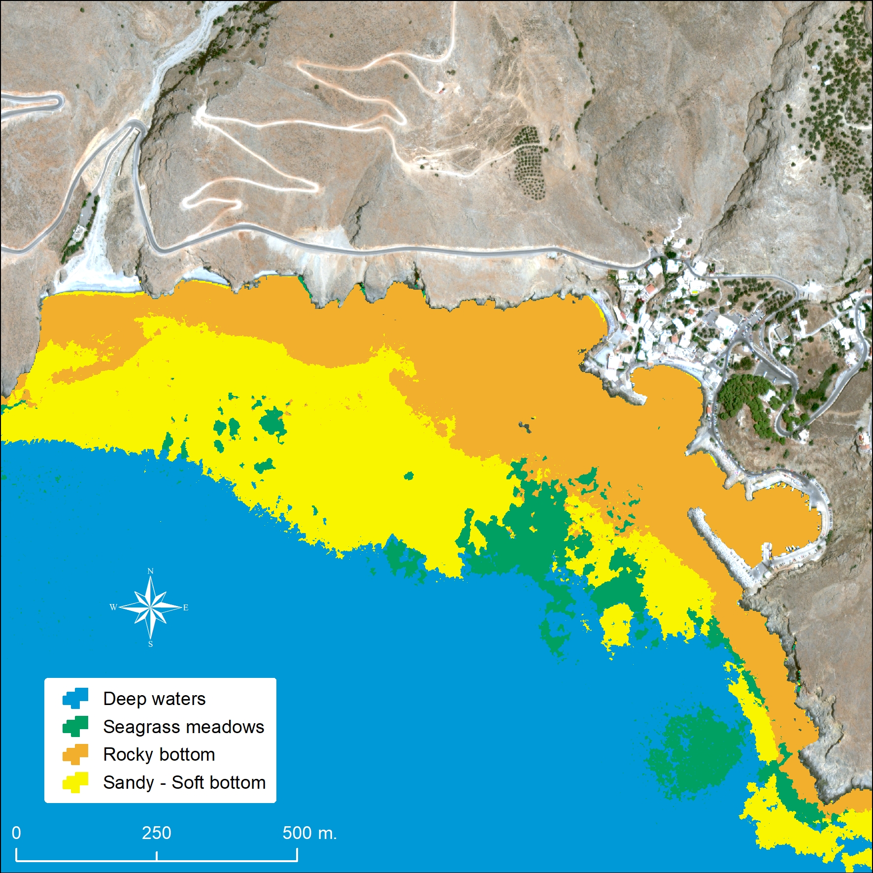
Urban development, port facilities and tourism are among the activities that developed at the transition zone between land and sea. Therefore, the pressure at the coastal ecosystems is high, while often their quality degraded. Earth Observation is used in coastal habitat mapping and monitoring, including the unique seagrass meadows, as well as in estimations of multiscale and hypertemporal satellite bathymetry. Advanced methods on the retrieval of bottom reflectance are used for the reduction of the influence of the water column while machine learning algorithms are used for the retrieval of the coastal habitats. Long time series data at high spatial resolution (Big Data) are used for habitat monitoring and changes in bathymetry that influence navigation and maritime safety.
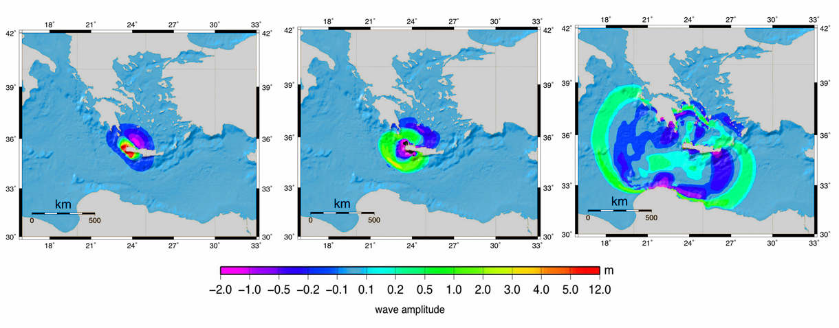
Tsunamis : Numerical Simulation and Hazard Assesment
We use numerical methods for the shallow water equations to simulate tsunami generation, propagation and runup, and estimate tsunami hazard in the Greek and surrounding seas, with special emphasis to Crete, with modern methodologies coupled with accurate bathymetry/topography data. We perform vulnerability and risk analyses of coastal areas studying the exposure of population, buildings, and other infrastructure of social and economic importance in order to produce detailed hazard maps. Our aim is to provide information that could contribute in decision making for the management of risk. We also perform basic research on numerical methods for shallow water equations and related models.
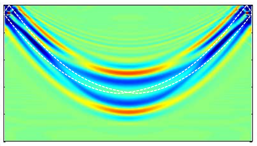
Ocean acoustic propagation modeling
Mathematical
models are developed that simulate acoustic wave propagation in the underwater environment.
These models solve boundary value problems in unbounded domains based on the
wave equation, the Helmholtz equation and its parabolic approximation and can
be used to predict the acoustic field in environments of arbitrary bathymetry,
bottom structure and sound-speed distribution. In addition efficient methods are
designed for the calculation of broadband acoustic fields and associated
time-frequency analysis
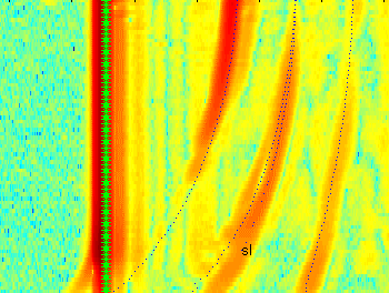
Ocean acoustic tomography
In
the field of ocean acoustic tomography (use of sound to sample sound-speed and
temperature changes in the water column in the large scale) focus is given on
the development of enhanced analysis methods for tomographic data, based on
wave-theoretic propagation modeling. Emphasis is given on modeling and
sensitivity analysis of tomographic observables, methods for adaptive
non-linear inversion, matched-field and matched-mode methods, statistical
signal identification and inversion schemes, as well as schemes for automated
analysis of tomography data.
Inverse scattering in waveguides
The
research in this area focuses on the reconstruction of velocity inhomogeneities
from point source data for the wave equation, and on the study of global
uniqueness for the reconstruction of the refraction index from the DtN (Dirichlet
to Neuman) map for the Helmholtz equation, on complex geometric optics for
waveguides as well as on the reconstruction of hard obstacles in homogeneous
waveguides
Sea-bed identification
Sea-bed
identification is focused on the development of inversion methods using either
local reflections from the sea-bed or measurements of the sound field at long
range. Inversion procedures based on optimization schemes are being developed. The
tank facility of the Laboratory of Underwater Acoustic Measurements is used in
order to perform experiments associated with local reflection problems and
validate inversion schemes.
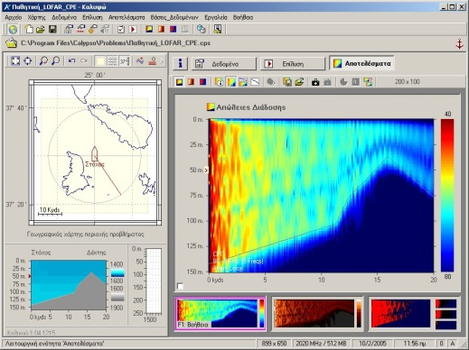
Underwater acoustic signal processing, detection and localization
Underwater
acoustic propagation modeling is combined with statistical signal processing,
detection and estimation theory for the analysis of underwater acoustic
surveillance (SONAR) systems, active (monostatic and multistatic) and passive
(broadband and LOFAR). Further, new methods for statistical characterization of
underwater acoustic signals are developed as a means for enhanced tomographic
and geoacoustic surveillance. Methods for the localization of sound sources
from their acoustic field using ray- and wave-theoretic propagation modeling
are developed.
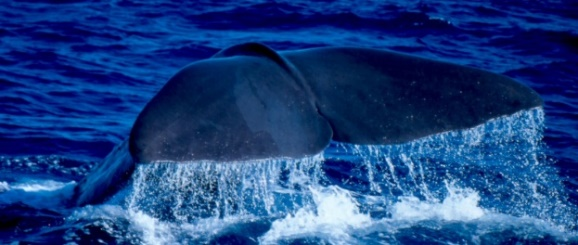
Marine bioacoustics
Ocean
bioacoustics focuses on the acoustic characteristics and behavior of marine
mammals, such as sperm whales, and fish. Methods and tools for the analysis and
characterization of cetacean sounds as well as for passive localization of
vocalizing animals in the sea are developed. Further, experiments in fish tanks
are conducted to record, identify and analyze sounds produced by commercially
interesting fish species, such as Sparus Aurata and Dicentrarchus Labrax.
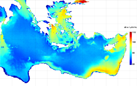
Ambient noise
Modelling
of shipping noise at IACM started in the late 1980s. More recently, an
operational system has been developed for real-time shipping noise prediction
in the Eastern Mediterranean Sea using real-time AIS data and wave propagation
modeling (http://www.iacm.forth.gr/shipnoise/). In addition, autonomous noise recorders are
being developed that can be used for monitoring in the framework of the MSFD
(EU Marine Strategy Framework Directive). Further, there is ongoing work on the
spatial coherence of the ambient noise field, in connection with passive
tomography relying on cross-correlation of the noise field at different
locations and the emergence of the time-domain Green’s function.
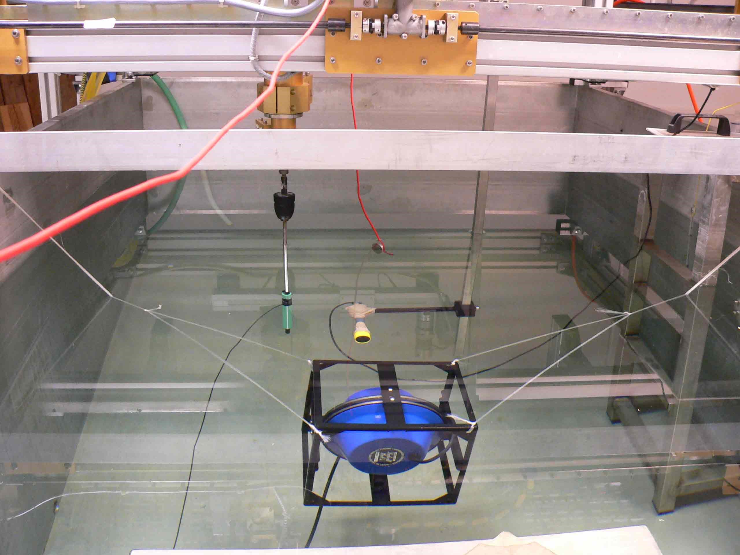
Acoustic Transducer Calibration
Calibration
of acoustical instruments such as hydrophones is a necessary step before
instruments can be used in experiments taking place in the laboratory or in the
sea. Different methods of calibration are used. The calibration procedure can
be carried out in situ (in the sea or in a lake), in the laboratory (in a water
tank or in air depending on the frequency band of interest).
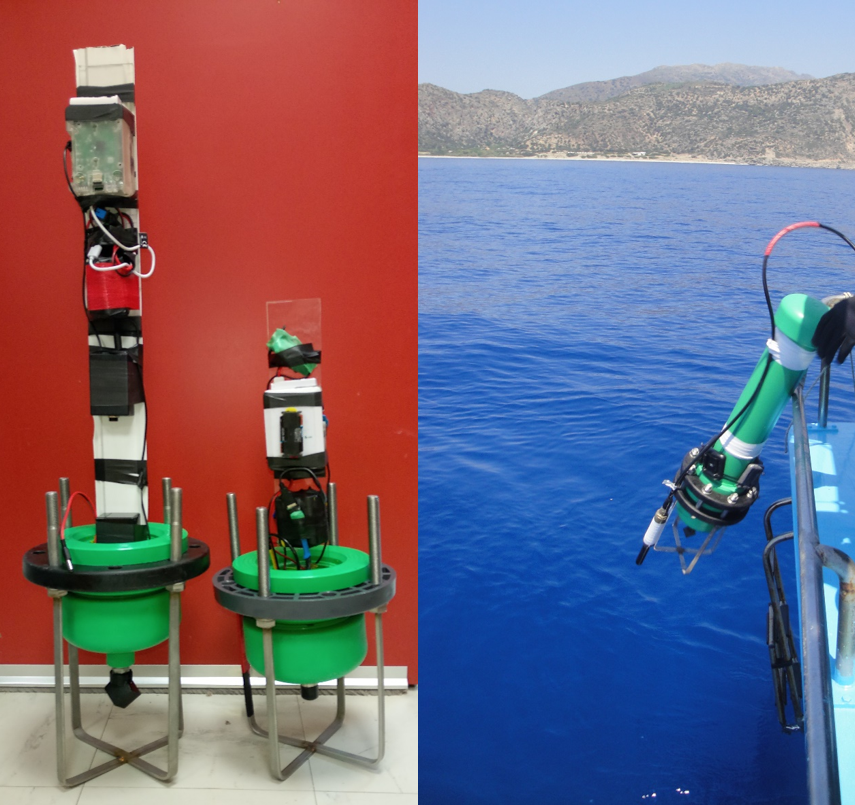
Development of underwater autonomous recorders
Underwater
sound measurements are becoming of great importance as they are essential to
evaluate the impact of anthropogenic activities on ocean ecosystems. The use of
commercially available underwater recorders is not always the most feasible
alternative, due to their high cost and lack of flexibility. Design and
construction of low-cost recorders using custom-made or readily available parts
can provide a realistic solution. Hardware and software components are combined
to develop underwater recorders with novel properties (programmability, durability,
long lasting deployment, customizable frequency band response, etc.).