 Institute of Applied and Computational Mathematics
IACM is one of the few research institutes in Europe dedicated to promoting the use of advanced mathematics in natural sciences and engineering
Institute of Applied and Computational Mathematics
IACM is one of the few research institutes in Europe dedicated to promoting the use of advanced mathematics in natural sciences and engineering
Infrastructure / Equipment
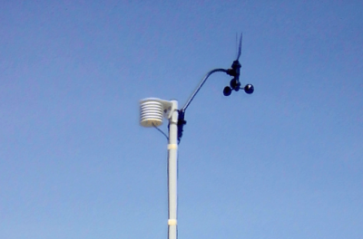
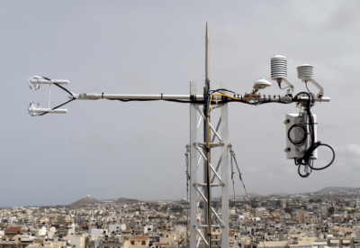
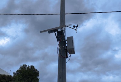
FIXED STATIONS
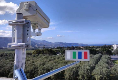
- Wireless Network of Meteorological Stations
The Remote Sensing Lab of IACM has installed a Wireless Weather Meteorological Network of 14 stations covering the wider area of the city of Heraklion. All Stations are equipped with Air Temperature (TAir)/ Relative Humidity (RH) Sensors, 7 Stations are equipped with Wind Speed / Wind Direction Sensors and 1 Station is equipped with a Rain Bucket and a Total Solar Radiation Sensor, providing on-line intra-urban meteorological measurements. For more information see here.
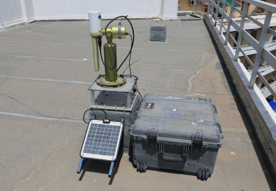
- Flux Towers
The Remote Sensing Lab of IACM has installed two Flux Towers in the city of Heraklion monitoring turbulent sensible and latent heat fluxes, net all-wave radiation flux and CO2 flux. Both are equipped with IRGASON Integrated CO2/H2O Open-Path Gas Analysers, 3D Sonic Anemometers and CNR1/CNR4 Net Radiometers. For more information see here.
- Air Quality Network Stations
The Remote Sensing Lab of IACM operates Air Quality Network Stations installed in Athens, in Thessaloniki and in Heraklion. For more information see here.
- PhenoCams
The Remote Sensing Lab of IACM operates phenocams installed in Berlin, Heraklion and Paris in the framework of the urbisphere ERC Synergy Grant. For more information see here.
- Aerosol Robotic Network (AERONET) System
AERONET deploys ground-based remote sensing providing observations of spectral aerosol optical depth (AOD), inversion products, and precipitable water in diverse aerosol regimes and adopts Sun and Lunar scenarios for collecting spectral measurements of the atmosphere. The Remote Sensing Lab of IACM has installed and operates an AERONET System including a Cimel Multiband Photometer at Heraklion city center. For more information see here.
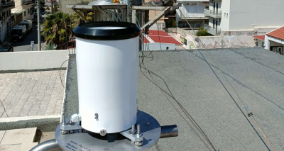
- Rain Gauge
The Remote Sensing Lab of IACM has installed a HD2015 rain gauge at the HECMAS-ICOS Associated flux tower. The gauge, with direct online data delivery, enhances real-time analysis and supports the research on urban fluxes. For more information see here.
- Seismological Station
The Wave propagation group of IACM has installed a seismological station at IACM-FORTH campus for continuous monitoring of the seismicity in the area of Heraklion. The station is linked to the Hellenic Seismological Broadband Network of the National Observatory of Athens (NOA_HL). For more information see here.
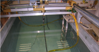
- Experimental tank
The Laboratory of Underwater Acoustic Measurements of IACM owns and operates an experimental tank (2,5m x 1,5m x 1,3m) with electronically controlled system of axes with two independent arms and four degrees of freedom, a pulser-receiver, a waveform generator, oscilloscopes, Signal and Power Amplifiers, Data Acquisition cards (on board and USB), Ultrasonic transducers (200-700kHz) and laboratory omni-directional hydrophones (10Ηz -120kHz). For more information see here.
DRONES & ROBOTS
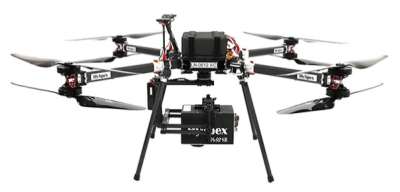
- Unmanned Aerial System (UAS) with Hyperspectral Camera
The Remote Sensing Lab of IACM owns/operates a Drone equipped with the HySpex Mjolnir Hyperspectral Imaging System for Unmanned Aerial Vehicle. Its Hyperspectral Camera covers a wide spectrum of ultraviolet/visible/near infrared measurements (400-2500nm). For more information see here.
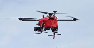
- Unmanned AerialSystems (UAS) with Optical and Thermal Cameras
The Remote Sensing Lab of IACM owns/operates two Unmanned Aerial Systems with optical and thermal cameras. The T-Drone M-1000 is equipped with two cameras: one optical and one thermal. The Parrot ANAFI Thermal is equipped with RGB/Thermal Camera. For more information see here.
- Unmanned Aerial System with Thermal Camera
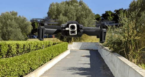
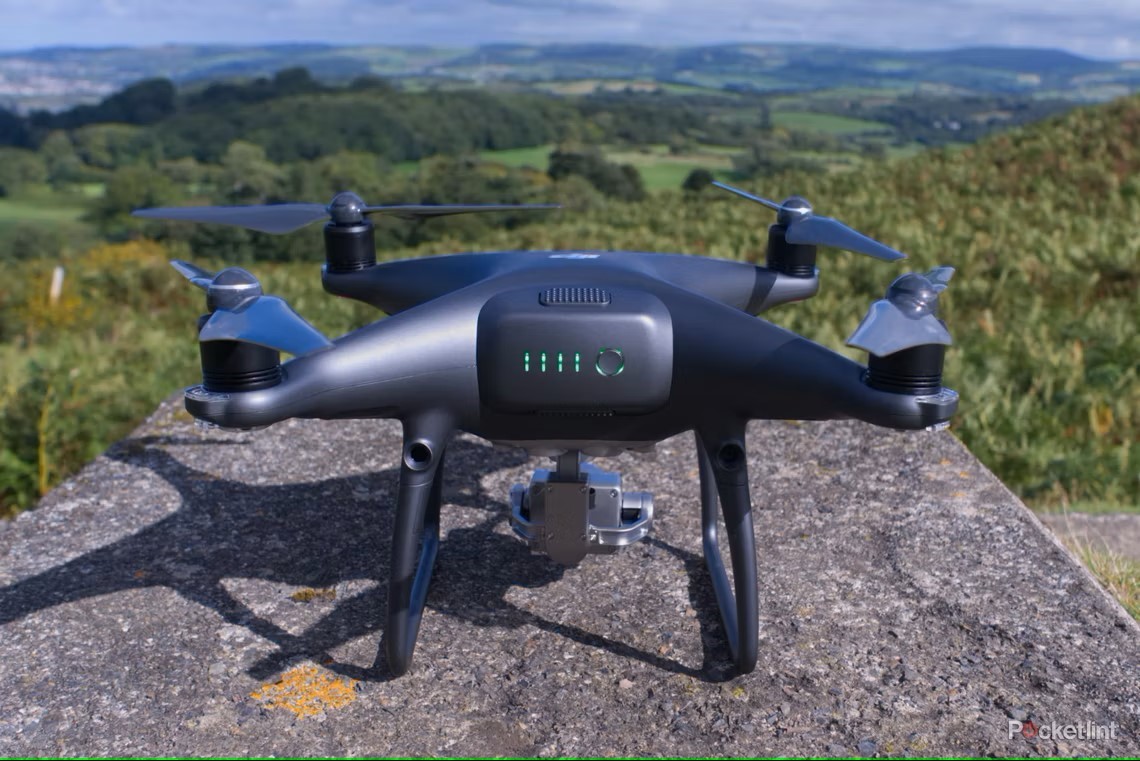
- Drone DJI Phantom 4 Pro V2
The Coastal and Marine Research Lab of IACM owns/operates one portable marine survey equipment Drone with 7km Radius equipped with high definition camera. For more information see here.
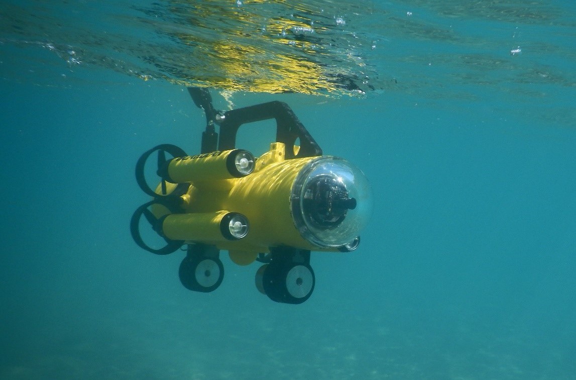
- Mini-ROV Guardian robot
The Coastal and Marine Research Lab of IACM owns/operates one ROV mini Grardian with 150m operational depth, equipped with onboard cameras LYYN, Laser and Cygnus sensors, and also water and sediment samplers. For more information see here.
PORTABLE EQUIPMENT
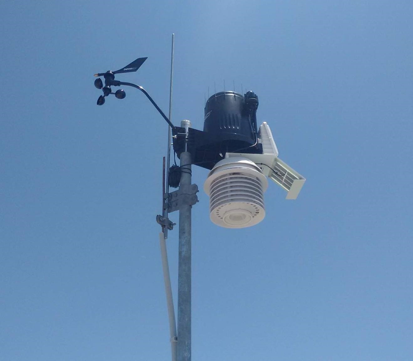
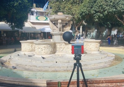
- Aspirated Radiation Shield and UV & Solar Radiation sensors
The Coastal and Marine Research Lab of IACM owns/operates three Davis Vantage Pro2 Plus, 24-hr Fan-Aspirated Radiation Shield and UV & Solar Radiation sensors, meteorological stations, currently deployed in various areas. The sensor suite combines an anemometer measuring wind speed, a direction vane measuring wind direction, a rain collector, a temperature and a humidity sensor. The particular Met. Stations, are very versatile and easily installed in a variety of climatic conditions and different terrains and makes them ideal for accurate measuring campaigns.
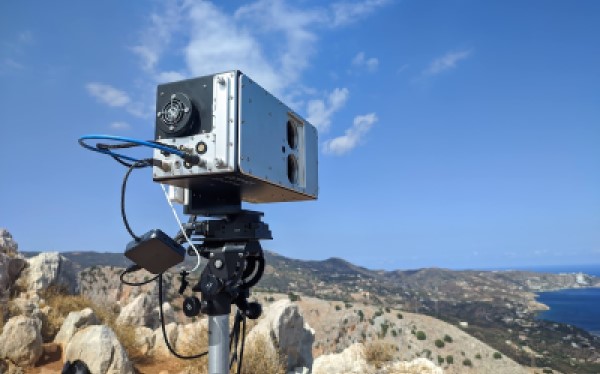
- HySpex hyperspectral camera
The Remote Sensing Lab of IACM owns/operates a HySpex Mjolnir VS-620 hyperspectral camera. In addition to the high-quality hyperspectral data cube, double resolution data in the VNIR range is always readily available. Ground-based operations are possible using proper tripod, whereas flight campaigns are also possible using proper UAS (Hercules X8 - HySpex Edition) available in RSLab. For more information see here.
- Area Heat Stress Monitors
The Remote Sensing Lab of IACM owns/operates QUESTemp° 36 Area Heat Stress Monitors are designed to evaluate potential heat stress in the environment. These instruments deliver monitoring through Wet Bulb Globe Temperature (WBGT) sensing technology and the calculation of a WBGT index value. For more information see here.
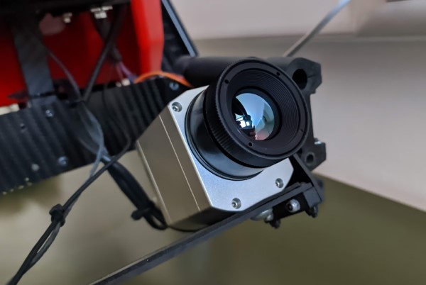
- Optris Infrared camera
The Remote Sensing Lab of IACM owns/operates a thermal imager Οptris PI 640i which is the smallest measuring VGA infrared camera worldwide and delivers pin-sharp radiometric pictures and videos in real time. Ground-based operations are possible using proper tripod, whereas flight campaigns are also possible using proper UAS available in RSLab. For more information see here.
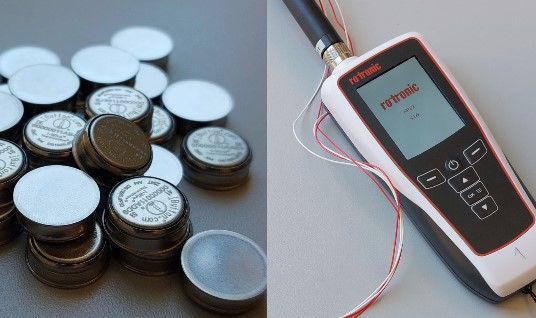
- Surface Thermometers
The Remote Sensing Lab of IACM posseses a number of iButton Thermochron devices and two high accuracy Rotronic HygroPalm HP32 sensors. For more information see here.
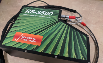
- Field Spectroradiometer
The Remote Sensing Lab of IACM owns a Field Portable Spectroradiometer (RS-3500) covers the full-spectrum of ultraviolet/visible/near infrared measurements (350-2500 nm) with just one scan. It can be operated by one person and is accompanied with a handheld Computer. For more information see here.
- Telraam S2
The Remote Sensing Lab of IACM owns/operates a device that has been designed and built from scratch for the specific purpose of counting traffic. It operates completely autonomously thanks to the built-in mobile data connection, and the remote device management tools. For more information see here.

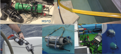
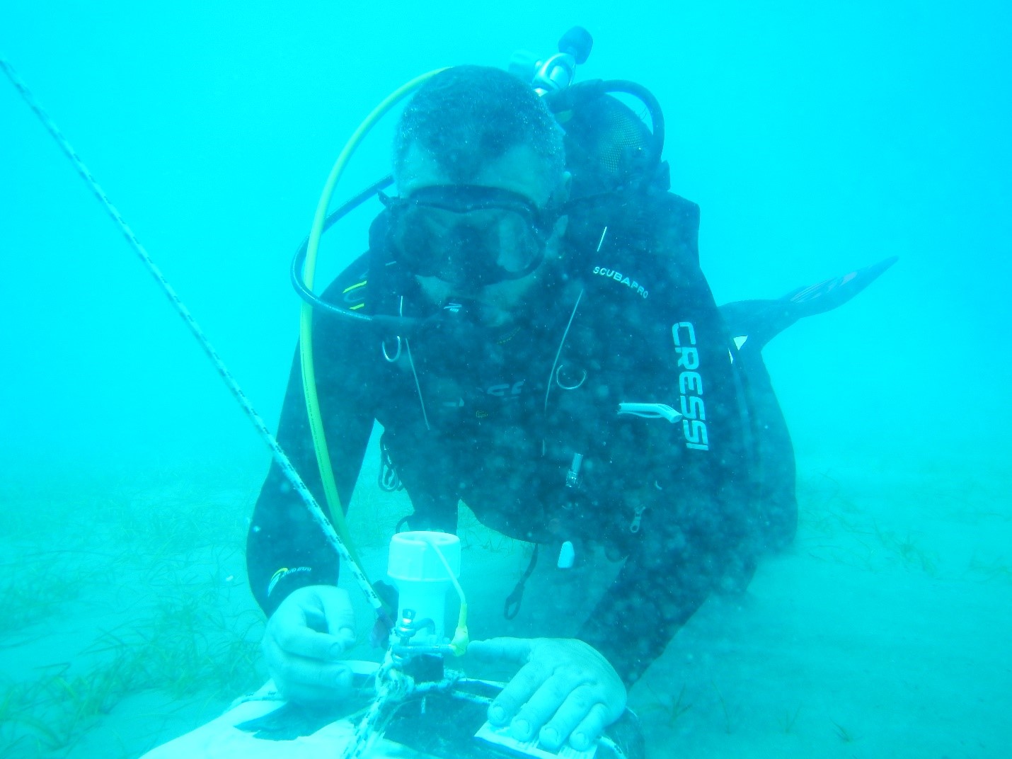
- Open Sea Experiment infrastructure
The Laboratory of Underwater Acoustic Measurements of IACM owns/operates open sea experiment infrastructure including one low frequency sound source, two towed array systems with three and two hydrophones, omni-directional hydrophones (10Ηz -280kHz), pingers, transponders, and temperature, depth and underwater noise recorders. For more information see here.
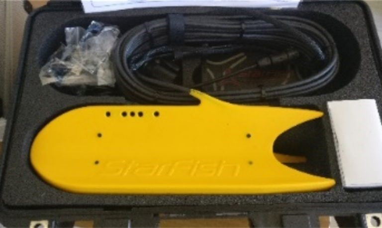
- Wave & tide sensors and side scan sonars
The Coastal and Marine Research Lab of IACM owns/operates portable wave & tide sensors and side scan sonars.
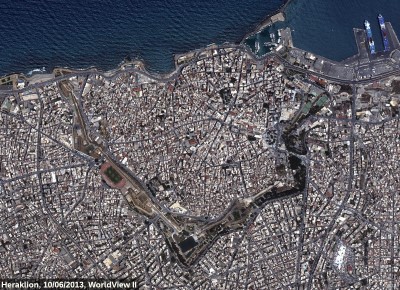
- VHR Satellite Imagery
The Remote Sensing Lab of IACM owns a series of Very High Spatial Resolution Satellite Imagery acquired from commercial satellite platforms. Most of them cover urban areas providing the spatiotemporal evolution of several cities. For more information see here.